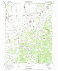
1961 Map of South Salem
USGS Topo · Published 1990About this map
The village of South Salem anchors this landscape in the early 1960s, situated near the intersection of Township Sch and several local routes. The geography is defined by the sharp contrast between the northern agricultural plains of Buckskin and the heavily ridged terrain to the south. Two major rail lines, the Baltimore and Ohio Railroad and the Detroit Toledo and Ironton Railroad, cross the northern and western sections of the map, supporting small settlements like Lyndon and Thrifton.
Find a feature on this map
72 named features on this map. Tap any name to fly to it.
Don’t see what you’re looking for? This feature index may not catch every label — zoom into the map to look around manually.
Map Details
Editions of this 1961 South Salem Map
3 editions found
Other maps of this area

1912 · Roxabell
USGS Topo · 1:62,500

1914 · Roxabell
USGS Topo · 1:62,500

1915 · Bainbridge
USGS Topo · 1:48,000

1915 · Piketon
USGS Topo · 1:62,500

1917 · Bainbridge
USGS Topo · 1:62,500

1917 · Piketon
USGS Topo · 1:62,500

1917 · Greenfield
USGS Topo · 1:62,500

1944 · Piketon
USGS Topo · 1:62,500

1944 · Greenfield
USGS Topo · 1:62,500

1944 · Roxabell
USGS Topo · 1:62,500