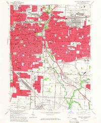
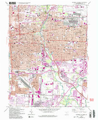
1964 Map of Southeast Columbus
USGS Topo · Published 1966About this map
The eastern urban corridors of Columbus and Bexley define this mid-1960s landscape, illustrating a period of significant municipal expansion and infrastructure development. The sheet highlights the convergence of the Pennsylvania, Norfolk and Western, and Chesapeake and Ohio railroads, which once drove the industrial character of the region. Notable institutional sites such as the Fort Hayes Mil Res and the expansive Dept of Defense Supply Center sit alongside neighborhood landmarks like the St Josephs Academy & Ch.
Find a feature on this map
74 named features on this map. Tap any name to fly to it.
Don’t see what you’re looking for? This feature index may not catch every label — zoom into the map to look around manually.
Map Details
Editions of this 1964 Southeast Columbus Map
5 editions found
Other maps of this area

1901 · Dublin
USGS Topo · 1:62,500

1902 · Westerville
USGS Topo · 1:62,500

1903 · Dublin
USGS Topo · 1:62,500

1904 · Westerville
USGS Topo · 1:62,500

1923 · West Columbus
USGS Topo · 1:62,500

1925 · East Columbus
USGS Topo · 1:62,500

1925 · West Columbus
USGS Topo · 1:62,500

1943 · East Columbus
USGS Topo · 1:62,500

1947 · Columbus
USGS Topo · 1:250,000

1950 · Marion
USGS Topo · 1:250,000