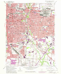
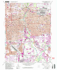
1964 Map of Southeast Columbus
USGS Topo · Published 1975About this map
The eastern expansion of Columbus and the neighboring enclave of Bexley define this mid-century landscape, where a dense urban grid meets significant institutional and military installations. The U S Dept of Defense Supply Center and the U S Reservation occupy massive tracts in the northeast, while Port Columbus International Airport anchors the edge of the city. For those tracing the civic and religious fabric of the era, the map meticulously documents numerous parochial and public institutions, from St Mary of the Springs College to the cluster of Jewish cemeteries including Agudas Achim Cem and Beth Jacob Cem.
Find a feature on this map
95 named features on this map. Tap any name to fly to it.
Don’t see what you’re looking for? This feature index may not catch every label — zoom into the map to look around manually.
Map Details
Editions of this 1964 Southeast Columbus Map
5 editions found
Other maps of this area

1901 · Dublin
USGS Topo · 1:62,500

1902 · Westerville
USGS Topo · 1:62,500

1903 · Dublin
USGS Topo · 1:62,500

1904 · Westerville
USGS Topo · 1:62,500

1923 · West Columbus
USGS Topo · 1:62,500

1925 · East Columbus
USGS Topo · 1:62,500

1925 · West Columbus
USGS Topo · 1:62,500

1943 · East Columbus
USGS Topo · 1:62,500

1947 · Columbus
USGS Topo · 1:250,000

1950 · Marion
USGS Topo · 1:250,000