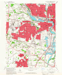
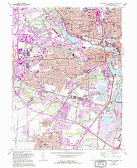
1965 Map of Southwest Columbus
USGS Topo · Published 1967About this map
The Scioto River and Olentangy River define the core of this mid-1960s landscape, where industrial infrastructure meets dense residential growth. The eastern edge of the map is dominated by institutional landmarks, including the Ohio State Penitentiary and the expansive grounds of the Columbus State Hospital. This era shows the city pushing westward past Valley View and southward toward Grove City, with a massive grid of suburban streets and new facilities like the Bishop Ready High Sch filling in the territory between established rail lines.
Find a feature on this map
82 named features on this map. Tap any name to fly to it.
Don’t see what you’re looking for? This feature index may not catch every label — zoom into the map to look around manually.
Map Details
Editions of this 1965 Southwest Columbus Map
5 editions found
Other maps of this area

1901 · Dublin
USGS Topo · 1:62,500

1902 · Westerville
USGS Topo · 1:62,500

1903 · Dublin
USGS Topo · 1:62,500

1904 · Westerville
USGS Topo · 1:62,500

1923 · West Columbus
USGS Topo · 1:62,500

1925 · East Columbus
USGS Topo · 1:62,500

1925 · West Columbus
USGS Topo · 1:62,500

1943 · East Columbus
USGS Topo · 1:62,500

1947 · Columbus
USGS Topo · 1:250,000

1950 · Marion
USGS Topo · 1:250,000