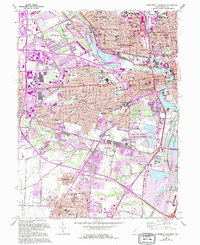
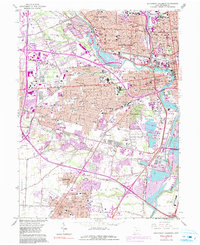
1965 Map of Southwest Columbus
USGS Topo · Published 1995About this map
The Scioto River and OlentangY River converge in this mid-century view of the Ohio capital's southwest quadrant, illustrating a landscape of institutional campuses and expanding suburban networks. Large-scale public works and research facilities like the Battelle Memorial Institute and the Filtration Plant sit alongside significant historical markers such as Greenlawn Cemetery and the Camp Chase Cem, a site of Civil War heritage.
Find a feature on this map
104 named features on this map. Tap any name to fly to it.
Don’t see what you’re looking for? This feature index may not catch every label — zoom into the map to look around manually.
Map Details
Editions of this 1965 Southwest Columbus Map
5 editions found
Other maps of this area

1901 · Dublin
USGS Topo · 1:62,500

1902 · Westerville
USGS Topo · 1:62,500

1903 · Dublin
USGS Topo · 1:62,500

1904 · Westerville
USGS Topo · 1:62,500

1923 · West Columbus
USGS Topo · 1:62,500

1925 · East Columbus
USGS Topo · 1:62,500

1925 · West Columbus
USGS Topo · 1:62,500

1943 · East Columbus
USGS Topo · 1:62,500

1947 · Columbus
USGS Topo · 1:250,000

1950 · Marion
USGS Topo · 1:250,000