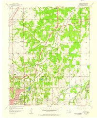
1956 Map of Spencer
USGS Topo · Published 1957About this map
Oklahoma City expands toward the northeast in the mid-1950s, where residential developments meet a landscape defined by industry and burial grounds. The mid-century character of this area is heavily shaped by its transport corridors and petroleum activity, with numerous Oil Wells and Gas Wells dotting the sections between Witcher and Spencer. The northeastern reaches of the city are anchored by large recreational and institutional sites, including the expansive Lincoln Park and Northeast Lake.
Find a feature on this map
40 named features on this map. Tap any name to fly to it.
Don’t see what you’re looking for? This feature index may not catch every label — zoom into the map to look around manually.
Map Details
Editions of this 1956 Spencer Map
3 editions found
Other maps of this area

1892 · Moore
USGS Topo · 1:62,500

1892 · Edmond
USGS Topo · 1:62,500

1892 · Kingfisher
USGS Topo · 1:125,000

1893 · Oklahoma City
USGS Topo · 1:62,500

1895 · Kingfisher
USGS Topo · 1:125,000

1898 · Purcell
USGS Topo · 1:125,000

1904 · Chickasha
USGS Topo · 1:125,000

1934 · Crutcho Creek
USGS Topo · 1:24,000

1934 · Moore
USGS Topo · 1:62,500

1935 · Spencer
USGS Topo · 1:24,000