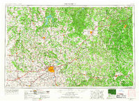
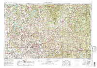
1954 Map of Springfield
USGS Topo · Published 1967About this map
Springfield sits at the heart of this regional study, which captures the mid-century development of the Missouri Ozarks. The infrastructure of the Springfield hub is well-established, featuring academic institutions like Southwest Missouri State College and Drury College, alongside the Springfield National Cemetery. To the southwest, the Wilson's Creek Battlefield National Park preserves a critical site of local history near the James River.
Find a feature on this map
209 named features on this map. Tap any name to fly to it.
Don’t see what you’re looking for? This feature index may not catch every label — zoom into the map to look around manually.
Map Details
Editions of this 1954 Springfield Map
6 editions found

Other maps of this area

1884 · Springfield
USGS Topo · 1:125,000

1884 · Bolivar
USGS Topo · 1:125,000

1886 · Nevada
USGS Topo · 1:125,000

1886 · Stockton
USGS Topo · 1:125,000

1886 · Greenfield
USGS Topo · 1:125,000

1886 · Carthage
USGS Topo · 1:125,000

1886 · Springfield
USGS Topo · 1:125,000

1887 · Clinton
USGS Topo · 1:125,000

1887 · Warsaw
USGS Topo · 1:125,000

1887 · Butler
USGS Topo · 1:125,000