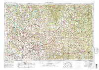
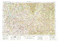
1954 Map of Springfield
USGS Topo · Published 1980About this map
Springfield serves as the focal point of the Ozark Plateau in the mid-1950s, a period of significant regional transit and institutional growth. The map illustrates the convergence of major corridors like U.S. Highway 66 and the St. Louis-San Francisco Railway, which supported the city's emergence as a medical and educational hub for Southwest Missouri. Local landmarks such as Drury College and the Lester E. Cox Medical Center are established features of the urban landscape.
Find a feature on this map
314 named features on this map. Tap any name to fly to it.
Don’t see what you’re looking for? This feature index may not catch every label — zoom into the map to look around manually.
Map Details
Editions of this 1954 Springfield Map
6 editions found

Other maps of this area

1884 · Springfield
USGS Topo · 1:125,000

1884 · Bolivar
USGS Topo · 1:125,000

1886 · Nevada
USGS Topo · 1:125,000

1886 · Stockton
USGS Topo · 1:125,000

1886 · Greenfield
USGS Topo · 1:125,000

1886 · Carthage
USGS Topo · 1:125,000

1886 · Springfield
USGS Topo · 1:125,000

1887 · Clinton
USGS Topo · 1:125,000

1887 · Warsaw
USGS Topo · 1:125,000

1887 · Butler
USGS Topo · 1:125,000