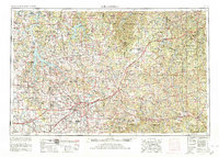
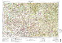
1954 Map of Springfield
USGS Topo · Published 1980About this map
Springfield serves as the regional hub for the Ozark Plateau, anchored by major institutions like Southwest Missouri State College and Drury College. The post-war expansion of the 1950s and 1960s is evident in the development around Springfield Municipal Airport and the complex web of highways, including the famous U S Highway 66. To the east, the sprawling Fort Leonard Wood Military Reservation dominates the landscape, while the emergence of major reservoirs like Stockton Lake and Pomme De Terre Lake indicates the mid-century transformation of the local river systems for flood control and recreation. Genealogists will find a wealth of data in the numerous mapped burial grounds, from the large Springfield National Cemetery to rural sites like Mount Comfort Cemetery, providing a detailed view of the area's settlement patterns before later suburban growth.
Find a feature on this map
398 named features on this map. Tap any name to fly to it.
Don’t see what you’re looking for? This feature index may not catch every label — zoom into the map to look around manually.
Map Details
Editions of this 1954 Springfield Map
6 editions found

Other maps of this area

1884 · Springfield
USGS Topo · 1:125,000

1884 · Bolivar
USGS Topo · 1:125,000

1886 · Nevada
USGS Topo · 1:125,000

1886 · Stockton
USGS Topo · 1:125,000

1886 · Greenfield
USGS Topo · 1:125,000

1886 · Carthage
USGS Topo · 1:125,000

1886 · Springfield
USGS Topo · 1:125,000

1887 · Clinton
USGS Topo · 1:125,000

1887 · Warsaw
USGS Topo · 1:125,000

1887 · Butler
USGS Topo · 1:125,000