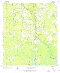
1963 Map of Springfield
USGS Topo · Published 1977About this map
The Natalbany River and Tickfaw River define the water-bound landscape of this Livingston Parish region during the early 1960s. The settlement of Springfield serves as a central hub, surrounded by a dense network of country churches and family burial grounds that speak to the area's deep-rooted social fabric. Notable religious and educational landmarks include the Hungarian Ch and the Albany-Springfield High Sch, alongside numerous smaller congregations like Jerusalem Ch and St James Ch. To the south, the landscape transitions into the riverine reaches of the Tickfaw River, where features like Warsaw Landing, Rose Mound, and Brier Patch Island highlight the importance of the river systems. The map also captures the smaller communities of Wadesboro and Rosaryville, providing a detailed view of the rural homesteads and cemeteries, such as Carters Cem and Galilee Cem, that anchor the local genealogy.
Find a feature on this map
43 named features on this map. Tap any name to fly to it.
Don’t see what you’re looking for? This feature index may not catch every label — zoom into the map to look around manually.
Map Details
Editions of this 1963 Springfield Map
4 editions found
Other maps of this area

1934 · Springfield
USGS Topo · 1:62,500

1935 · Ponchatoula
USGS Topo · 1:62,500

1939 · Ponchatoula
USGS Topo · 1:62,500

1939 · Springfield
USGS Topo · 1:62,500

1940 · Tickfaw
USGS Topo · 1:31,680

1949 · Albany
USGS Topo · 1:31,680

1950 · Doyle
USGS Topo · 1:31,680

1951 · Ponchatoula
USGS Topo · 1:62,500

1954 · Baton Rouge
USGS Topo · 1:250,000

1956 · Baton Rouge
USGS Topo · 1:250,000