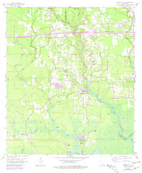
1963 Map of Springfield
USGS Topo · Published 1981About this map
Springfield serves as the focal point of this coastal plain landscape, situated where the Natalbany River winds toward its confluence with the Tickfaw River. The map reflects a transition in the late twentieth century as Interstate 12 cuts a modern path across the northern half of the parish, contrasting with the older river-oriented settlements like Warsaw Landing and Wadesboro. These riverine communities speak to an era of transport defined by water and rail, even as new landmarks such as Pumpkin Center and various gravel pits appear.
Find a feature on this map
46 named features on this map. Tap any name to fly to it.
Don’t see what you’re looking for? This feature index may not catch every label — zoom into the map to look around manually.
Map Details
Editions of this 1963 Springfield Map
4 editions found
Other maps of this area

1934 · Springfield
USGS Topo · 1:62,500

1935 · Ponchatoula
USGS Topo · 1:62,500

1939 · Ponchatoula
USGS Topo · 1:62,500

1939 · Springfield
USGS Topo · 1:62,500

1940 · Tickfaw
USGS Topo · 1:31,680

1949 · Albany
USGS Topo · 1:31,680

1950 · Doyle
USGS Topo · 1:31,680

1951 · Ponchatoula
USGS Topo · 1:62,500

1954 · Baton Rouge
USGS Topo · 1:250,000

1956 · Baton Rouge
USGS Topo · 1:250,000