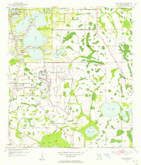
1953 Map of St. Cloud North
USGS Topo · Published 1964About this map
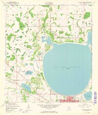
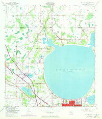
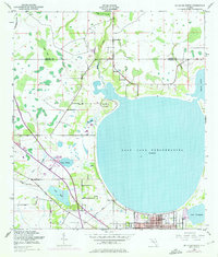
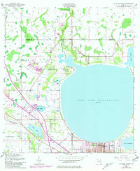
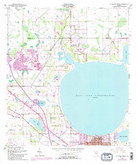
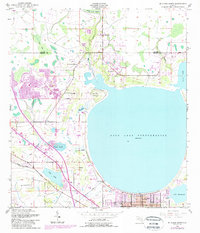
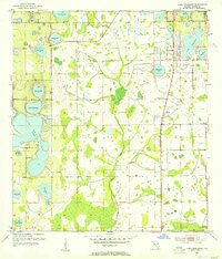
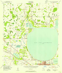
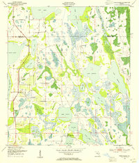
East Lake Tohopekaliga dominates this central Florida landscape, its circular shoreline defining the northern boundary of St Cloud. The survey reflects a transitional period for Osceola County, where the street grid of the town meets a complex network of wetlands and water management features. To the north, the Orange Co Osceola Co line bisects Boggy Creek Swamp, while the southern reaches of the map show early hydraulic modifications like the Partin Canal and the St Cloud Canal.
Find a feature on this map
19 named features on this map. Tap any name to fly to it.
Don’t see what you’re looking for? This feature index may not catch every label — zoom into the map to look around manually.
Map Details
Editions of this 1953 St. Cloud North Map
7 editions found
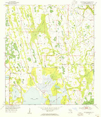
Other maps of this area
1953 · Lake Jessamine
USGS Topo · 1:24,000
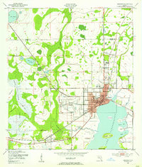
1953 · St Cloud North
USGS Topo · 1:24,000
1953 · Narcoossee
USGS Topo · 1:24,000
1953 · St Cloud South
USGS Topo · 1:24,000
1953 · Lake Tohopekaliga
USGS Topo · 1:24,000
1953 · Ashton
USGS Topo · 1:24,000
1953 · Pine Castle
USGS Topo · 1:24,000
1953 · Kissimmee
USGS Topo · 1:24,000
1953 · Narcoossee NW
USGS Topo · 1:24,000

1955 · Orlando
USGS Topo · 1:250,000