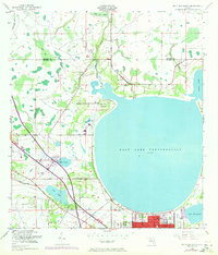
1953 Map of St Cloud North
USGS Topo · Published 1972About this map
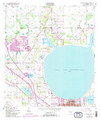
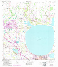
The town of St Cloud and the expansive waters of East Lake Tohopekaliga anchor this mid-century survey of the Florida interior. This period of mapping shows a landscape transitioning between its rural agricultural roots and modern infrastructure. The northern reaches are dominated by the Boggy Creek Swamp and the Boggy Creek drainage, while the southern portion reveals the organized street grid of St Cloud nestled between Fish Lake and Lake Runnymede.
Find a feature on this map
24 named features on this map. Tap any name to fly to it.
Don’t see what you’re looking for? This feature index may not catch every label — zoom into the map to look around manually.
Map Details
Editions of this 1953 St Cloud North Map
7 editions found
Other maps of this area

1953 · Lake Jessamine
USGS Topo · 1:24,000

1953 · St Cloud North
USGS Topo · 1:24,000

1953 · Narcoossee
USGS Topo · 1:24,000

1953 · St Cloud South
USGS Topo · 1:24,000

1953 · Lake Tohopekaliga
USGS Topo · 1:24,000

1953 · Ashton
USGS Topo · 1:24,000

1953 · Pine Castle
USGS Topo · 1:24,000

1953 · Kissimmee
USGS Topo · 1:24,000

1953 · Narcoossee NW
USGS Topo · 1:24,000

1955 · Orlando
USGS Topo · 1:250,000