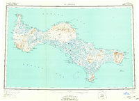
1948 Map of St Lawrence
USGS Topo · Published 1958About this map
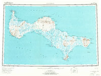
St. Lawrence Island appears in the mid-twentieth century as a complex landscape of subsistence camps and indigenous settlements in the Bering Sea. The map highlights traditional hubs like Gambell at Northwest Cape and Savoonga on the northern coast, alongside numerous specialized outposts such as Siknik Trapping Camp and Reindeer Camp. These labels reflect a land-use pattern centered on seasonal resource cycles and reindeer herding, with many sites designated as camps rather than permanent villages. Inland, the Kookooligit Mountains and Sevuokuk Mtn dominate the topography, while the coast is deeply articulated by extensive water bodies like Koozata Lagoon and Powooiliak Bay. A unique glimpse into the island’s deep history is found at Kookoolik (Old Village Site), marking a former settlement location near the northern shore. The network of trails connecting these remote points underscores the island's isolation and its reliance on traditional travel routes between the sea and interior highlands.
Find a feature on this map
135 named features on this map. Tap any name to fly to it.
Don’t see what you’re looking for? This feature index may not catch every label — zoom into the map to look around manually.
Map Details
Editions of this 1948 St Lawrence Map
7 editions found
Other maps of this area

1948 · St Lawrence
USGS Topo · 1:250,000

1949 · St Lawrence
USGS Topo · 1:250,000

1964 · St Lawrence
USGS Topo · 1:250,000
2020 · Saint Lawrence A-0 NW
USGS Topo · 1:25,000
2020 · Saint Lawrence B-5 NW
USGS Topo · 1:25,000

2020 · Saint Lawrence C-4 NE
USGS Topo · 1:25,000

2020 · Saint Lawrence D-5 SW
USGS Topo · 1:25,000
2020 · Saint Lawrence B-0 NE
USGS Topo · 1:25,000

2020 · Saint Lawrence C-4 SE
USGS Topo · 1:25,000
2020 · Saint Lawrence A-2 NE
USGS Topo · 1:25,000