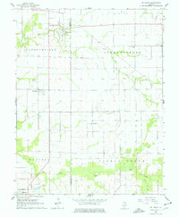
1964 Map of St. Libory
USGS Topo · Published 1977About this map
St Libory sits near the northern boundary of this mid-century landscape, serving as a focal point for a rural community defined by the St Clair Co Washington Co line. The map captures a transition between the established village of Marissa and its predecessor, Old Marissa, to the south. The area is intersected by the winding paths of Little Mud Creek and Mud Creek, which dictate the placement of early infrastructure like the Johannisburg Sch and various local cemeteries.
Find a feature on this map
21 named features on this map. Tap any name to fly to it.
Don’t see what you’re looking for? This feature index may not catch every label — zoom into the map to look around manually.
Map Details
Editions of this 1964 St. Libory Map
2 editions found
Other maps of this area

1910 · Okawville
USGS Topo · 1:62,500

1912 · New Athens
USGS Topo · 1:62,500

1912 · Baldwin
USGS Topo · 1:62,500

1914 · Baldwin
USGS Topo · 1:62,500

1914 · Coulterville
USGS Topo · 1:62,500

1917 · Coulterville
USGS Topo · 1:62,500

1940 · Okawville
USGS Topo · 1:62,500

1942 · Baldwin
USGS Topo · 1:62,500
1954 · Mascoutah
USGS Topo · 1:24,000
1954 · New Athens East
USGS Topo · 1:24,000