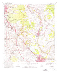
1970 Map of St. Martinville
USGS Topo · Published 1976About this map
Bayou Teche winds through the heart of this Acadian landscape, connecting the growing hubs of St Martinville and New Iberia. The map illustrates a region where traditional river-based life meets mid-century industrial expansion, evidenced by the presence of the Acadiana Regional Airport and the Cypress Island Oil and Gas Field. Rural life remains anchored by historical landholdings such as the Romero Plantation, Interlachen Plantation, and Hopeland Plantation.
Find a feature on this map
71 named features on this map. Tap any name to fly to it.
Don’t see what you’re looking for? This feature index may not catch every label — zoom into the map to look around manually.
Map Details
Editions of this 1970 St. Martinville Map
2 editions found
Other maps of this area

1932 · Abbeville NE
USGS Topo · 1:31,680

1935 · Osca Bayou
USGS Topo · 1:62,500

1937 · Jeanerette
USGS Topo · 1:62,500

1937 · Derouen
USGS Topo · 1:62,500

1939 · St. Martinsville
USGS Topo · 1:62,500

1940 · Arnaudville
USGS Topo · 1:62,500

1941 · Loreauville
USGS Topo · 1:62,500

1945 · New Orleans
USGS Topo · 1:250,000

1946 · Milton
USGS Topo · 1:31,680

1946 · Lafayette
USGS Topo · 1:31,680