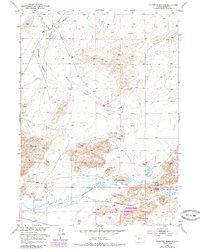
1951 Map of Stampede Meadow
USGS Topo · Published 1985About this map
The Sweetwater River flows through this high-desert landscape in central Wyoming, serving as a vital corridor for both 19th-century pioneers and mid-20th-century ranchers. This survey documents the Emigrant Oregon Trail as it parallels the river, passing significant landmarks like the Historical Site "Three Crossings" and a Historical Site (Stage Station and Grave). These locations provide tangible links to the era of western migration and the Pony Express route.
Find a feature on this map
21 named features on this map. Tap any name to fly to it.
Don’t see what you’re looking for? This feature index may not catch every label — zoom into the map to look around manually.
Map Details
Editions of this 1951 Stampede Meadow Map
3 editions found
Other maps of this area

1951 · Crooks Creek NE
USGS Topo · 1:24,000

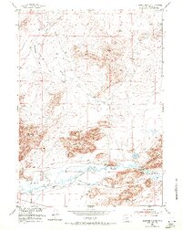
1951 · Stampede Meadow
USGS Topo · 1:24,000

1951 · Black Rock Gap
USGS Topo · 1:24,000

1951 · Graham Ranch
USGS Topo · 1:24,000

1951 · Split Rock NW
USGS Topo · 1:24,000

1951 · Crooks Mountain
USGS Topo · 1:24,000

1952 · Tin Cup Mountain
USGS Topo · 1:24,000

1952 · Muskrat Basin
USGS Topo · 1:24,000

1952 · Coyote Springs
USGS Topo · 1:24,000

1955 · Casper
USGS Topo · 1:250,000