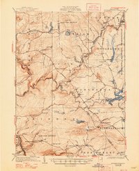
1924 Map of Stoddartsville
USGS Topo · Published 1948About this map
Stoddartsville sits at a geographic crossroads in the upper Poconos, where the Lehigh River and Tobyhanna Creek wind through a landscape defined by timber, early recreation, and military presence. This 1920s survey captures a transition in the region, documenting the Tobyhanna Military Reservation on the eastern edge and the sprawling State Game Preserve to the north. The area is dotted with small mountain settlements like Thornhurst and Albrightsville, alongside specialized institutions like the Fishery School and the Hickory Run School. Transportation is characterized by the winding routes of the Easton road and the Wilkes-Barre road, which connected these high-elevation communities before the modern highway system. Local industry and family history are evident in the naming of features such as Bradys Switch, Snider Run, and Porter Run, illustrating the early 20th-century footprint of Carbon and Monroe counties.
Find a feature on this map
105 named features on this map. Tap any name to fly to it.
Don’t see what you’re looking for? This feature index may not catch every label — zoom into the map to look around manually.
Map Details
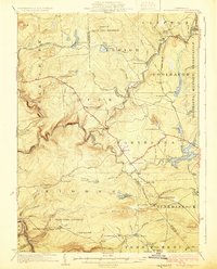
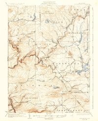
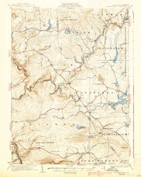
Editions of this 1924 Stoddartsville Map
5 editions found

Other maps of this area

1889 · Scranton
USGS Topo · 1:62,500

1889 · Hazleton
USGS Topo · 1:62,500

1891 · Wilkesbarre
USGS Topo · 1:62,500

1891 · Hazleton
USGS Topo · 1:62,500

1891 · Scranton
USGS Topo · 1:62,500

1893 · Hazleton
USGS Topo · 1:62,500

1893 · Pittston
USGS Topo · 1:62,500

1893 · Scranton
USGS Topo · 1:62,500

1894 · Wilkesbarre
USGS Topo · 1:62,500

1914 · Wind Gap
USGS Topo · 1:62,500
Featured Places
- Clifton Township, PA
- Thornhurst Township, PA
- Kidder Township, PA
- Buck Township, PA
- Pocono Pines, Tobyhanna Township