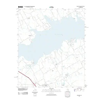
2010 Map of Streetman
USGS Topo · Published 2010About this map
Streetman serves as the primary hub in this corner of East Texas, where the landscape is defined by the expansive waters of Texas Industries Lake. This reservoir dominates the central geography, its complex shoreline protected by the Texas Industries Levee near Cheneyboro. The map reveals a rural infrastructure of small airfields, including BT Averheart Airport and Byrt Airport, alongside a widespread network of local county roads and state farm-to-market routes.
Find a feature on this map
56 named features on this map. Tap any name to fly to it.
Don’t see what you’re looking for? This feature index may not catch every label — zoom into the map to look around manually.
Map Details
Editions of this 2010 Streetman Map
This is the sole edition of this map. No revisions or reprints were ever made.
Other maps of this area

1954 · Dallas
USGS Topo · 1:250,000

1954 · Waco
USGS Topo · 1:250,000

1955 · Waco
USGS Topo · 1:250,000

1958 · Dallas
USGS Topo · 1:250,000

1959 · Powell
USGS Topo · 1:24,000

1960 · Winkler
USGS Topo · 1:24,000

1960 · Streetman
USGS Topo · 1:24,000

1960 · Goodlow Park
USGS Topo · 1:24,000

1963 · Richland
USGS Topo · 1:24,000

1963 · Wortham
USGS Topo · 1:24,000