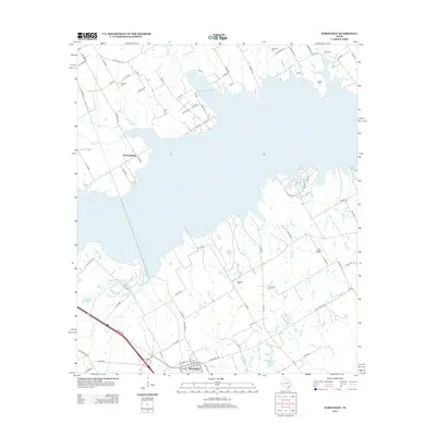
2013 Map of Streetman
USGS Topo · Published 2013About this map
Streetman serves as the primary hub in this Navarro County landscape, where the town layout meets a complex network of ranch roads and rural lanes. The area is defined by the significant reach of Texas Industries Lake, which dominates the northern and central portions of the map with its irregular shoreline and flooded creek beds. For genealogists and local historians, several family and community burial sites are scattered throughout the countryside, including Hopewell Cem, Birdston Cem, and Johnson Cem. The settlement at Cheneyboro sits west of the main lake body, connected by routes like Ranch Road 3243. This survey captures the rural character of the region as it balances modern infrastructure, such as Byrt Airport, with the natural flow of Grape Cr and Spring Br.
Find a feature on this map
85 named features on this map. Tap any name to fly to it.
Don’t see what you’re looking for? This feature index may not catch every label — zoom into the map to look around manually.
Map Details
Editions of this 2013 Streetman Map
This is the sole edition of this map. No revisions or reprints were ever made.
Other maps of this area

1954 · Dallas
USGS Topo · 1:250,000

1954 · Waco
USGS Topo · 1:250,000

1955 · Waco
USGS Topo · 1:250,000

1958 · Dallas
USGS Topo · 1:250,000

1959 · Powell
USGS Topo · 1:24,000

1960 · Winkler
USGS Topo · 1:24,000

1960 · Streetman
USGS Topo · 1:24,000

1960 · Goodlow Park
USGS Topo · 1:24,000

1963 · Richland
USGS Topo · 1:24,000

1963 · Wortham
USGS Topo · 1:24,000