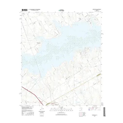
2016 Map of Streetman
USGS Topo · Published 2016About this map
The boundary between Navarro and Freestone counties is defined by the expansive waters of the Richland-Chambers Reservoir and the industrial landscape of Texas Industries Lake. This mid-2010s survey reveals a region shaped by modern water management and the enduring presence of rural settlements like Streetman and Eureka. The terrain is marked by numerous family and community burial grounds, including Birdston Cem and Hopewell Cem, which serve as vital touchstones for genealogical research in this part of East Texas. To the south, Emerson Lake Number 1 and Emerson Lake Number 2 dot the landscape near the small community of Cheneyboro. The map documents a network of rural roads and county routes that navigate the complex shoreline and the remaining agricultural land between the large artificial reservoirs.
Find a feature on this map
85 named features on this map. Tap any name to fly to it.
Don’t see what you’re looking for? This feature index may not catch every label — zoom into the map to look around manually.
Map Details
Editions of this 2016 Streetman Map
This is the sole edition of this map. No revisions or reprints were ever made.
Other maps of this area

1954 · Dallas
USGS Topo · 1:250,000

1954 · Waco
USGS Topo · 1:250,000

1955 · Waco
USGS Topo · 1:250,000

1958 · Dallas
USGS Topo · 1:250,000

1959 · Powell
USGS Topo · 1:24,000

1960 · Winkler
USGS Topo · 1:24,000

1960 · Streetman
USGS Topo · 1:24,000

1960 · Goodlow Park
USGS Topo · 1:24,000

1963 · Richland
USGS Topo · 1:24,000

1963 · Wortham
USGS Topo · 1:24,000