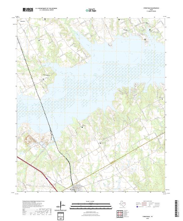
2022 Map of Streetman
USGS Topo · Published 2022About this map
Texas Industries Lake dominates the central landscape of this contemporary survey, its intricate shoreline carving into the clay hills of the Navarro and Freestone county line. The map reveals a high concentration of small, family-named burial sites that speak to the deep-rooted agricultural history of the region. From the northern reaches near Navarro and Eureka down to the town of Streetman, the land is dotted with historic markers including Boyd Cem, Hopewell Cem, and Birdston Cem. These cemeteries, often the last physical remnants of early settlements, are linked by a complex network of county roads such as FM 1243 and SE Co Rd 2170. The terrain is further defined by seasonal drainage ways like Crab Cr and Grape Cr, which feed into the larger reservoir system that has fundamentally altered the local topography since the early twentieth century.
Find a feature on this map
104 named features on this map. Tap any name to fly to it.
Don’t see what you’re looking for? This feature index may not catch every label — zoom into the map to look around manually.
Map Details
Editions of this 2022 Streetman Map
This is the sole edition of this map. No revisions or reprints were ever made.
Other maps of this area

1954 · Dallas
USGS Topo · 1:250,000

1954 · Waco
USGS Topo · 1:250,000

1955 · Waco
USGS Topo · 1:250,000

1958 · Dallas
USGS Topo · 1:250,000

1959 · Powell
USGS Topo · 1:24,000

1960 · Winkler
USGS Topo · 1:24,000

1960 · Streetman
USGS Topo · 1:24,000

1960 · Goodlow Park
USGS Topo · 1:24,000

1963 · Richland
USGS Topo · 1:24,000

1963 · Wortham
USGS Topo · 1:24,000