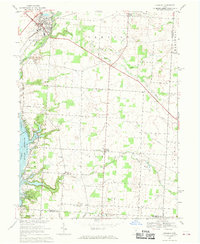
1967 Map of Sunbury
USGS Topo · Published 1969About this map
Sunbury and Galena serve as the primary hubs in this late-1960s landscape, which is defined by the expansive waters of the Hoover Reservoir and the drainage of Big Walnut Creek. The area shows a transition from traditional agricultural patterns to growing suburban influence, evidenced by the Big Walnut High Sch and the Penn Central rail line cutting through Berkshire and Trenton townships.
Find a feature on this map
41 named features on this map. Tap any name to fly to it.
Don’t see what you’re looking for? This feature index may not catch every label — zoom into the map to look around manually.
Map Details
Editions of this 1967 Sunbury Map
3 editions found
Other maps of this area

1902 · Westerville
USGS Topo · 1:62,500

1904 · Westerville
USGS Topo · 1:62,500

1908 · Granville
USGS Topo · 1:62,500

1910 · Granville
USGS Topo · 1:62,500

1915 · Marengo
USGS Topo · 1:62,500

1915 · Fredericktown
USGS Topo · 1:62,500

1943 · Marengo
USGS Topo · 1:62,500

1943 · Fredericktown
USGS Topo · 1:62,500

1950 · Marion
USGS Topo · 1:250,000
1954 · Northeast Columbus
USGS Topo · 1:24,000