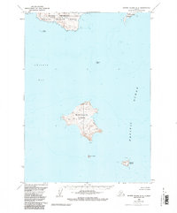
1963 Map of Sutwik Island B-6
USGS Topo · Published 1985About this map
Alaska Peninsula National Wildlife Refuge encompasses the northern coastal reaches of this survey, where the rugged mainland terminates at Cape Kumliun. This maritime landscape, as documented in the early 1960s, is defined by its scattered island chains and dangerous navigational hazards like Katmai Reef within the waters of Chignik Bay. Human presence is nearly invisible on the landscape, save for a solitary Cabin noted on the northern coast of Unavikshak Island. The map provides a detailed record of shoreline bathymetry and topography for several substantial landmasses, including Nakchamik Island and Atkulik Island, which sit isolated in the Pacific Ocean. This 1963 data, later updated with 1982 hydrographic information, preserves the mid-century state of these remote Aleutian Range foothills before modern environmental changes.
Find a feature on this map
11 named features on this map. Tap any name to fly to it.
Don’t see what you’re looking for? This feature index may not catch every label — zoom into the map to look around manually.
Map Details
Editions of this 1963 Sutwik Island B-6 Map
2 editions found
Other maps of this area

1951 · Sutwik Island
USGS Topo · 1:250,000

1963 · Chignik B-1
USGS Topo · 1:63,360

1963 · Chignik C-1
USGS Topo · 1:63,360

1963 · Sutwik Island B-6
USGS Topo · 1:63,360
1963 · Chignik A-1
USGS Topo · 1:63,360

1963 · Sutwik Island
USGS Topo · 1:250,000

1963 · Sutwik Island C-6
USGS Topo · 1:63,360

1963 · Chignik
USGS Topo · 1:250,000
1963 · Sutwik Island C-5
USGS Topo · 1:63,360
2019 · Sutwik Island C-5 SW
USGS Topo · 1:25,000