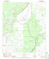
1982 Map of Swartz
USGS Topo · Published 1983About this map
Wham Brake and the expansive Russell Sage State Wildlife Management Area dominate this northeast Louisiana landscape, illustrating a region defined by managed wetlands and industrial gas extraction. The presence of the Monroe Gas Field indicates the economic significance of the area, while local history is preserved in rural pockets like Puckettville and Patrick. Transportation follows a grid of family-named corridors such as Stubbs-Vinson Road and McGowan Road, alongside the Missouri Pacific railroad. Genealogists will find several notable landmarks, including Wham Cem and Spring Hill Cem, as well as community gathering points like Bethel Ch and Lochabor Ch. The terrain transitions from the low-lying Swan Lake Lakebed to the edges of Little Bayou Boeuf, reflecting the complex water management of the Ouachita and Morehouse Parish borderlands.
Find a feature on this map
38 named features on this map. Tap any name to fly to it.
Don’t see what you’re looking for? This feature index may not catch every label — zoom into the map to look around manually.
Map Details
Editions of this 1982 Swartz Map
This is the sole edition of this map. No revisions or reprints were ever made.
Other maps of this area

1935 · Collinston
USGS Topo · 1:62,500

1935 · Alto
USGS Topo · 1:62,500

1935 · Drew
USGS Topo · 1:62,500

1940 · Monroe
USGS Topo · 1:62,500

1955 · Jackson
USGS Topo · 1:250,000

1955 · Shreveport
USGS Topo · 1:250,000

1956 · Shreveport
USGS Topo · 1:250,000

1957 · Monroe North
USGS Topo · 1:62,500

1957 · Mangham
USGS Topo · 1:62,500

1957 · Monroe South
USGS Topo · 1:24,000