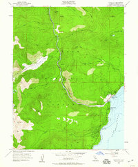
1955 Map of Tahoe City
USGS Topo · Published 1960About this map
Tahoe City serves as the focal point of this mid-century survey, situated at the northwest outlet of Lake Tahoe where the Truckee River begins its descent. The map illustrates the early recreational and residential development of the shoreline, featuring the landmark Tahoe Tavern and the Tahoe City Golf Course alongside civic foundations like the Tahoe Lake Sch and local Cem. The landscape is defined by the high peaks of the Sierra Nevada, including Mt Pluto, Mt Watson, and Ward Peak, which frame the deep glacial troughs of Squaw Valley and the surrounding Tahoe National Forest.
Find a feature on this map
46 named features on this map. Tap any name to fly to it.
Don’t see what you’re looking for? This feature index may not catch every label — zoom into the map to look around manually.
Map Details
Editions of this 1955 Tahoe City Map
4 editions found
Other maps of this area

1891 · Truckee
USGS Topo · 1:125,000

1893 · Truckee
USGS Topo · 1:125,000

1895 · Truckee
USGS Topo · 1:125,000

1932 · Truckee
USGS Topo · 1:96,000

1940 · Truckee
USGS Topo · 1:125,000

1953 · Granite Chief
USGS Topo · 1:24,000
1953 · Wentworth Springs
USGS Topo · 1:24,000

1953 · Granite Chief
USGS Topo · 1:62,500
1955 · Homewood
USGS Topo · 1:24,000

1955 · Truckee
USGS Topo · 1:24,000