
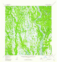
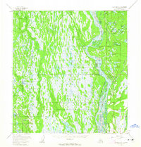
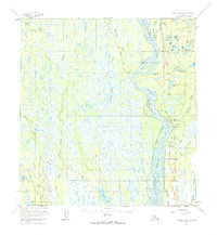
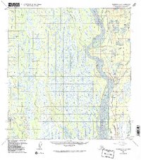
1958 Map of Talkeetna A-1
USGS Topo · Published 1987About this map
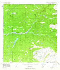
The Susitna River dominates this mid-century Alaskan interior landscape, acting as a braided lifeline through a network of muskeg and glacial lakes. Small settlements such as Sunshine and Montana are positioned along the critical transit corridor formed by the Alaska Railroad and the Parks Highway. This alignment of rail, road, and river highlights the region's mid-century development as a hub for transportation and small-scale habitation. The survey records a topography densely packed with named water bodies, from the expansive Trapper Lake to the small Section House Lake, indicating the importance of local hydrology to those navigating the area via the Winter Trail. Away from the main transit lines, the map reveals isolated landmarks like the Parker settlement and various aviation features including a Landing Strip, reflecting the remote logistics required for northern living before more modern infrastructure fully connected these boreal wetlands.
Find a feature on this map
44 named features on this map. Tap any name to fly to it.
Don’t see what you’re looking for? This feature index may not catch every label — zoom into the map to look around manually.
Map Details
Editions of this 1958 Talkeetna A-1 Map
5 editions found
Other maps of this area

1949 · Tyonek
USGS Topo · 1:250,000
1949 · Talkeetna Mountains B-6
USGS Topo · 1:63,360
1949 · Anchorage D-8
USGS Topo · 1:63,360

1950 · Talkeetna Mountains
USGS Topo · 1:250,000

1950 · Talkeetna
USGS Topo · 1:250,000
1950 · Talkeetna Mountains A-6
USGS Topo · 1:63,360
1951 · Talkeetna
USGS Topo · 1:250,000

1951 · Talkeetna B-1
USGS Topo · 1:63,360

1951 · Anchorage
USGS Topo · 1:250,000

1951 · Tyonek
USGS Topo · 1:250,000