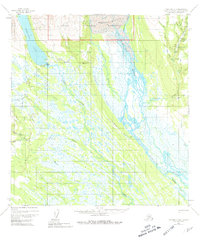
1954 Map of Talkeetna B-3
USGS Topo · Published 1981About this map
Denali National Monument occupies the northern reaches of this Alaskan interior landscape, where the massive Kahiltna Glacier feeds into the wide, braided channels of the Kahiltna River. This mid-century survey documents a frontier environment defined by seasonal access and remote outposts, centered around the Chelatna Lake area and the nearby Chelatna Lodge.
Find a feature on this map
34 named features on this map. Tap any name to fly to it.
Don’t see what you’re looking for? This feature index may not catch every label — zoom into the map to look around manually.
Map Details
Editions of this 1954 Talkeetna B-3 Map
4 editions found
Other maps of this area

1950 · Talkeetna
USGS Topo · 1:250,000

1951 · Talkeetna
USGS Topo · 1:250,000

1954 · Talkeetna A-3
USGS Topo · 1:63,360

1954 · Talkeetna B-4
USGS Topo · 1:63,360

1954 · Talkeetna A-2
USGS Topo · 1:63,360

1954 · Talkeetna A-4
USGS Topo · 1:63,360

1954 · Talkeetna B-3
USGS Topo · 1:63,360

1954 · Talkeetna B-2
USGS Topo · 1:63,360

1958 · Talkeetna C-4
USGS Topo · 1:63,360

1958 · Talkeetna C-2
USGS Topo · 1:63,360