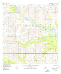
1958 Map of Talkeetna B-5
USGS Topo · Published 1980About this map
Denali National Monument defines the vast glacial and mountainous landscape of this 1958 survey, showing the territory before it was expanded into the modern national park system. The drainage patterns are dominated by the West Fork Yentna River, which cuts a wide path through the central valley, joined by tributaries like Cascade Creek and the long, winding Fourth of July Creek. In the southern reaches, the Kichatna River and Kakochna River flow through terrain that remained largely unsurveyed on the ground at the time of publication. A lone Cabin situated near the riverbanks serves as one of the few indicators of human presence in this wilderness, reflecting the era's reliance on aerial photogrammetry to map remote Alaskan regions where land lines were predetermined but not yet marked on the ground.
Find a feature on this map
7 named features on this map. Tap any name to fly to it.
Don’t see what you’re looking for? This feature index may not catch every label — zoom into the map to look around manually.
Map Details
Editions of this 1958 Talkeetna B-5 Map
3 editions found
Other maps of this area

1950 · Talkeetna
USGS Topo · 1:250,000

1951 · Talkeetna
USGS Topo · 1:250,000

1954 · Talkeetna B-4
USGS Topo · 1:63,360

1954 · Talkeetna A-4
USGS Topo · 1:63,360

1958 · Talkeetna A-6
USGS Topo · 1:63,360

1958 · Talkeetna A-5
USGS Topo · 1:63,360

1958 · Talkeetna B-5
USGS Topo · 1:63,360

1958 · Talkeetna B-6
USGS Topo · 1:63,360

1958 · Talkeetna C-6
USGS Topo · 1:63,360

1958 · Talkeetna C-4
USGS Topo · 1:63,360