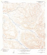
1952 Map of Talkeetna Mountains B-5
USGS Topo · Published 1952About this map
Talkeetna River and Sheep River define the lower elevations of this high-alpine landscape in the early 1950s, where glacial drainage patterns carve through the Talkeetna Mountains. The map reveals a nearly untouched wilderness punctuated only by a handful of remote structures, including a Cabin situated near the shores of Rainbow Lake. The presence of several Vertical Angle Bench Marks, such as VABM 4114 Disappointment and VABM 5545 Wells, indicates the surveyor's efforts to chart the towering peaks of Wells Mountain and the surrounding ridgelines. Significant tributaries like Iron Creek wind through the topography, with its own East Fork and Middle Fork shown in the eastern reaches, providing a detailed look at the drainage basins before any significant modern development or accessible road networks reached this portion of the interior.
Find a feature on this map
13 named features on this map. Tap any name to fly to it.
Don’t see what you’re looking for? This feature index may not catch every label — zoom into the map to look around manually.
Map Details
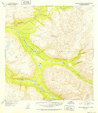
Editions of this 1952 Talkeetna Mountains B-5 Map
2 editions found
Other maps of this area

1949 · Talkeetna Mountains B-6
USGS Topo · 1:63,360

1949 · Talkeetna Mountains C-6
USGS Topo · 1:63,360

1949 · Talkeetna Mountains A-4
USGS Topo · 1:63,360

1950 · Talkeetna Mountains
USGS Topo · 1:250,000

1950 · Talkeetna Mountains B-5
USGS Topo · 1:63,360

1950 · Talkeetna Mountains B-4
USGS Topo · 1:63,360

1950 · Talkeetna Mountains A-6
USGS Topo · 1:63,360

1950 · Talkeetna Mountains A-5
USGS Topo · 1:63,360

1950 · Talkeetna Mountains C-5
USGS Topo · 1:63,360

1951 · Talkeetna Mountains C-4
USGS Topo · 1:63,360