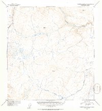
1952 Map of Talkeetna Mountains C-2
USGS Topo · Published 1953About this map
The Susitna River winds through the northern reaches of this interior Alaska landscape, captured during a 1952 survey of the Talkeetna Mountains. This remote high-country terrain is defined by a series of prominent peaks and drainage systems, with Clarence Lake serving as a central landmark for the surrounding hills. Several triangulation stations, including Vabm 4192 Windus and Vabm 5603 Goose, provide specific elevation control points across the mountainous divide. The presence of isolated Cabin sites near water sources like Gilbert Creek and Clarence Lake suggests the presence of seasonal trappers, hunters, or prospectors operating in the region. Tributaries such as Kosina Creek and Goose Creek etch deeply into the topography, illustrating the complex hydrology of the Matanuska-Susitna area before the introduction of modern infrastructure.
Find a feature on this map
11 named features on this map. Tap any name to fly to it.
Don’t see what you’re looking for? This feature index may not catch every label — zoom into the map to look around manually.
Map Details
Editions of this 1952 Talkeetna Mountains C-2 Map
2 editions found
Other maps of this area

1950 · Talkeetna Mountains
USGS Topo · 1:250,000

1951 · Talkeetna Mountains B-1
USGS Topo · 1:63,360

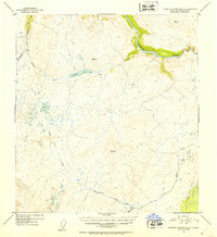
1951 · Talkeetna Mountains C-2
USGS Topo · 1:63,360

1951 · Talkeetna Mountains B-3
USGS Topo · 1:63,360

1951 · Talkeetna Mountains D-2
USGS Topo · 1:63,360

1951 · Talkeetna Mountains B-2
USGS Topo · 1:63,360

1951 · Talkeetna Mountains C-1
USGS Topo · 1:63,360

1951 · Talkeetna Mountains D-1
USGS Topo · 1:63,360

1951 · Talkeetna Mountains D-3
USGS Topo · 1:63,360

1951 · Talkeetna Mountains C-3
USGS Topo · 1:63,360