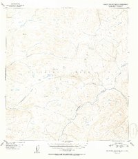
1952 Map of Talkeetna Mountains C-5
USGS Topo · Published 1952About this map
The Talkeetna River flows through this high-altitude landscape in the Alaska-Third Judicial Division, as documented in 1949 aerial surveys. The topography is dominated by the Talkeetna Mountains, where the drainage patterns of Chunilna Creek and Disappointment Creek reveal a complex network of glacial and mountain runoff. High points such as VABM 4149 Clear serve as primary survey markers across the elevation contours. This era of mapping captured the region before significant infrastructure reached these interior reaches, showing the natural course of Cache Creek and Prairie Creek before modern alterations. The sheet provides a clear view of the wilderness character of the Matanuska-Susitna region during the early 1950s.
Find a feature on this map
7 named features on this map. Tap any name to fly to it.
Don’t see what you’re looking for? This feature index may not catch every label — zoom into the map to look around manually.
Map Details
Editions of this 1952 Talkeetna Mountains C-5 Map
2 editions found
Other maps of this area

1949 · Talkeetna Mountains D-6
USGS Topo · 1:63,360

1949 · Talkeetna Mountains B-6
USGS Topo · 1:63,360

1949 · Talkeetna Mountains C-6
USGS Topo · 1:63,360

1950 · Talkeetna Mountains
USGS Topo · 1:250,000

1950 · Talkeetna Mountains B-5
USGS Topo · 1:63,360

1950 · Talkeetna Mountains B-4
USGS Topo · 1:63,360

1950 · Talkeetna Mountains D-5
USGS Topo · 1:63,360

1950 · Talkeetna Mountains C-5
USGS Topo · 1:63,360

1951 · Talkeetna Mountains D-5
USGS Topo · 1:63,360

1951 · Talkeetna Mountains C-4
USGS Topo · 1:63,360