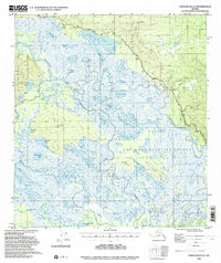
1948 Map of Tanacross A-3
USGS Topo · Published 2000About this map
The Tanana River and Tetlin River converge in a sprawling network of wetlands and seasonal waterways within what would become the Tetlin National Wildlife Refuge. This 1948 survey documents a remote interior landscape defined by its hydrology, featuring dozens of named water bodies such as Midway Lake, Nuziamundcho Lake, and Tlocogn Lake. The presence of a Sled Road, a Winter Trail, and several isolated cabins reflects the traditional transportation methods and seasonal subsistence patterns of the region's inhabitants prior to extensive modern development.
Find a feature on this map
42 named features on this map. Tap any name to fly to it.
Don’t see what you’re looking for? This feature index may not catch every label — zoom into the map to look around manually.
Map Details
Editions of this 1948 Tanacross A-3 Map
4 editions found
Other maps of this area

1948 · Tanacross A-3
USGS Topo · 1:63,360

1948 · Tanacross A-4
USGS Topo · 1:63,360

1948 · Tanacross B-3
USGS Topo · 1:63,360

1949 · Tanacross
USGS Topo · 1:250,000

1949 · Tanacross B-4
USGS Topo · 1:63,360

1949 · Tanacross B-3
USGS Topo · 1:63,360

1950 · Tanacross
USGS Topo · 1:250,000

1950 · Nabesna
USGS Topo · 1:250,000

1951 · Nabesna
USGS Topo · 1:250,000

1951 · Tanacross B-4
USGS Topo · 1:63,360