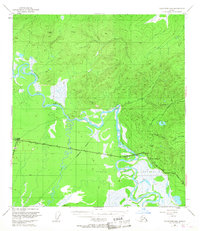
1949 Map of Tanacross B-4
USGS Topo · Published 1968About this map
The Tanana River winds through the heart of this mid-century Alaskan landscape, serving as the dominant geographical feature alongside the extensive Tetlin Indian Reservation. The mapping captures the strategic convergence of northern infrastructure, highlighting the junction of the Alaska Highway, Glenn Highway, and Taylor Highway. These vital transportation arteries intersect near the settlement of Tok, which is depicted with its early landing strip and pipeline markers.
Find a feature on this map
18 named features on this map. Tap any name to fly to it.
Don’t see what you’re looking for? This feature index may not catch every label — zoom into the map to look around manually.
Map Details
Editions of this 1949 Tanacross B-4 Map
3 editions found
Other maps of this area

1948 · Tanacross B-5
USGS Topo · 1:63,360

1948 · Tanacross A-3
USGS Topo · 1:63,360

1948 · Tanacross A-4
USGS Topo · 1:63,360

1948 · Tanacross A-5
USGS Topo · 1:63,360

1948 · Tanacross B-3
USGS Topo · 1:63,360

1949 · Tanacross
USGS Topo · 1:250,000

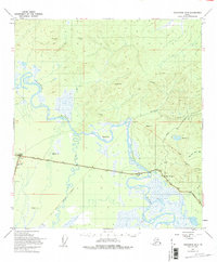
1949 · Tanacross B-4
USGS Topo · 1:63,360

1949 · Tanacross A-5
USGS Topo · 1:63,360

1949 · Tanacross B-3
USGS Topo · 1:63,360

1950 · Tanacross
USGS Topo · 1:250,000