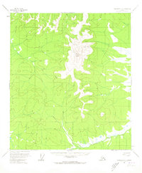
1956 Map of Tanacross C-3
USGS Topo · Published 1973About this map
Mount Fairplay dominates this 1950s landscape, serving as a central topographic anchor for the surrounding Interior Alaska wilderness. The Taylor Highway winds through the central portion of the quadrangle, representing the primary terrestrial link for the region during this era of post-war development. This transport artery follows the high ground, providing access to remote outposts such as the isolated Cabin located near the headwaters of Cabin Creek. To the south, the winding course of the Dennison Fork cuts through the terrain, illustrating the characteristic drainage patterns of the Yukon River basin. The map documents a landscape defined by its relative isolation, where named features are sparse and human presence is largely limited to the highway corridor and scattered survival structures.
Find a feature on this map
5 named features on this map. Tap any name to fly to it.
Don’t see what you’re looking for? This feature index may not catch every label — zoom into the map to look around manually.
Map Details
Editions of this 1956 Tanacross C-3 Map
3 editions found
Other maps of this area

1948 · Tanacross B-3
USGS Topo · 1:63,360

1949 · Tanacross
USGS Topo · 1:250,000

1949 · Tanacross B-4
USGS Topo · 1:63,360

1949 · Tanacross B-3
USGS Topo · 1:63,360

1950 · Tanacross
USGS Topo · 1:250,000

1951 · Tanacross B-4
USGS Topo · 1:63,360

1952 · Tanacross B-3
USGS Topo · 1:63,360

1956 · Tanacross D-3
USGS Topo · 1:63,360

1956 · Tanacross D-2
USGS Topo · 1:63,360

1956 · Tanacross C-3
USGS Topo · 1:63,360