1956 Map of Tanacross
USGS Topo · Published 1987About this map
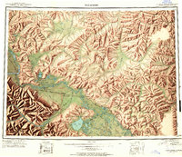
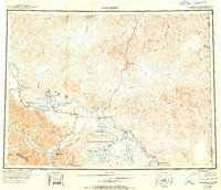
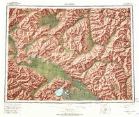
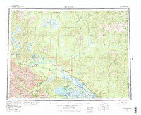
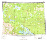
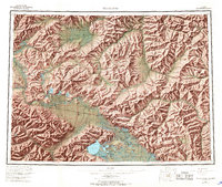
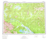
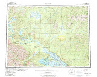
The Tanana River and its complex network of sloughs and tributaries define the interior Alaskan landscape in this mid-century survey. The area shows a critical juncture of early infrastructure where the Alaska Highway meets the Taylor Highway at Tetlin Junction, facilitating inland travel toward the Yukon border. Deeply rooted in the region's indigenous and pioneer history, the map records established communities such as Tanacross, Mansfield Village, and Last Tetlin Village, along with more isolated outposts like Mitchells Ranch and Titus Paul.
Find a feature on this map
105 named features on this map. Tap any name to fly to it.
Don’t see what you’re looking for? This feature index may not catch every label — zoom into the map to look around manually.
Map Details
Editions of this 1956 Tanacross Map
5 editions found
Historical Maps of Tok Through Time
4 maps found