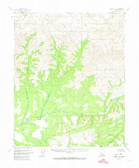
1956 Map of Tanana C-3
USGS Topo · Published 1974About this map
The Tozitna River winds through this interior landscape, defining the drainage patterns of a territory largely untouched by permanent settlement in the mid-1950s. The map reveals a complex network of tributaries, most notably the aptly named Spooky Valley and its accompanying Spooky Valley Creek. The terrain is characterized by intricate contouring that illustrates the high-relief basins of the Gishna Creek and Kubuk Creek watersheds.
Find a feature on this map
10 named features on this map. Tap any name to fly to it.
Don’t see what you’re looking for? This feature index may not catch every label — zoom into the map to look around manually.
Map Details
Editions of this 1956 Tanana C-3 Map
3 editions found
Other maps of this area

1951 · Tanana
USGS Topo · 1:250,000

1956 · Tanana D-2
USGS Topo · 1:63,360

1956 · Tanana D-4
USGS Topo · 1:63,360

1956 · Tanana B-2
USGS Topo · 1:63,360

1956 · Tanana D-3
USGS Topo · 1:63,360

1956 · Tanana C-3
USGS Topo · 1:63,360

1956 · Tanana B-3
USGS Topo · 1:63,360

1956 · Tanana C-2
USGS Topo · 1:63,360

1956 · Tanana C-4
USGS Topo · 1:63,360

1956 · Tanana B-4
USGS Topo · 1:63,360