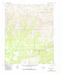
1956 Map of Tanana C-3
USGS Topo · Published 1985About this map
The Tozitna River winds through the central and southern reaches of this interior Alaskan landscape, serving as the primary drainage for numerous tributaries flowing from the surrounding uplands. Surveyed in the mid-1950s using photogrammetric methods, the map captures a wilderness area characterized by an intricate network of waterways, including Gishna Creek and Kobuk Creek. The northern portion of the quadrangle is defined by the Kilolitna River and the evocative Spooky Valley Creek, which flows through a distinctive valley system near the northwest corner.
Find a feature on this map
8 named features on this map. Tap any name to fly to it.
Don’t see what you’re looking for? This feature index may not catch every label — zoom into the map to look around manually.
Map Details
Editions of this 1956 Tanana C-3 Map
3 editions found
Other maps of this area

1951 · Tanana
USGS Topo · 1:250,000

1956 · Tanana D-2
USGS Topo · 1:63,360

1956 · Tanana D-4
USGS Topo · 1:63,360

1956 · Tanana B-2
USGS Topo · 1:63,360

1956 · Tanana D-3
USGS Topo · 1:63,360

1956 · Tanana C-3
USGS Topo · 1:63,360

1956 · Tanana B-3
USGS Topo · 1:63,360

1956 · Tanana C-2
USGS Topo · 1:63,360

1956 · Tanana C-4
USGS Topo · 1:63,360

1956 · Tanana B-4
USGS Topo · 1:63,360