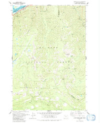
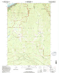
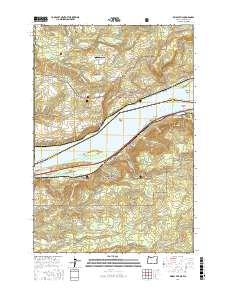
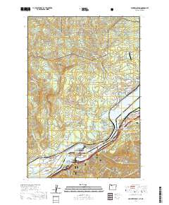
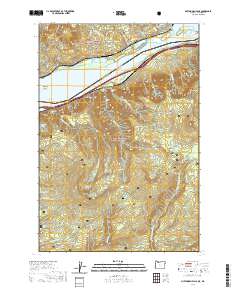
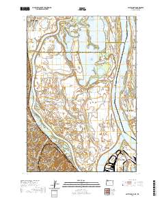
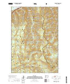
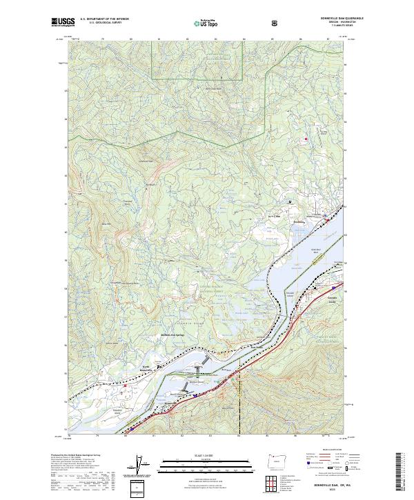
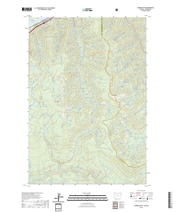
1979 Map of Tanner Butte
USGS Topo · Published 1992About this map
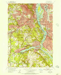
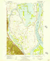
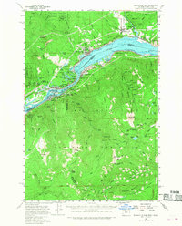
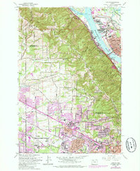
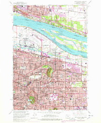
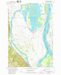
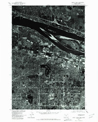
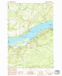
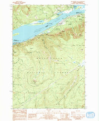
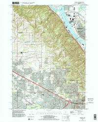
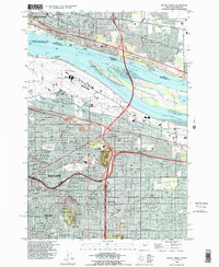
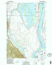
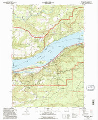
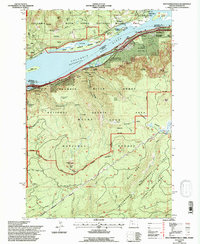
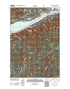
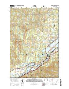
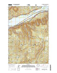
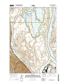
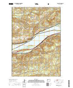
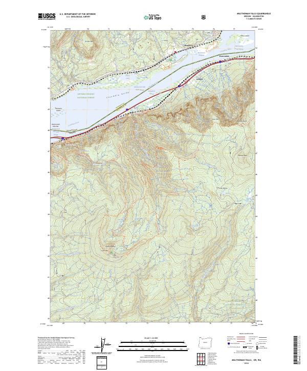
The Columbia River shoreline dominates the northern edge of this survey, where the Union Pacific railroad tracks and the boundaries of John B Yeon State Park follow the water's path. Moving south, the terrain rises sharply into the Mt Hood National Forest, defined by a dense network of hydrologic features including Wahkeena Falls, Elowah Falls, and Punch Bowl Falls. This landscape is heavily managed for conservation, as evidenced by the Bull Run Watershed Management Unit which covers the southern half of the quadrangle.
Find a feature on this map
45 named features on this map. Tap any name to fly to it.
Don’t see what you’re looking for? This feature index may not catch every label — zoom into the map to look around manually.
Map Details
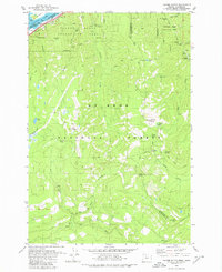
Editions of this 1979 Tanner Butte Map
2 editions found
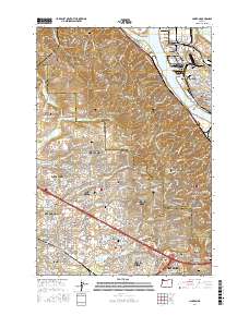
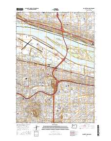
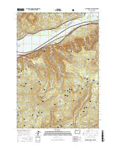
Historical Maps of Multnomah County Through Time
56 maps found
1954 Linnton
Multnomah County, OR
1954 Mount Tabor
Multnomah County, OR
1954 Oswego
Multnomah County, OR
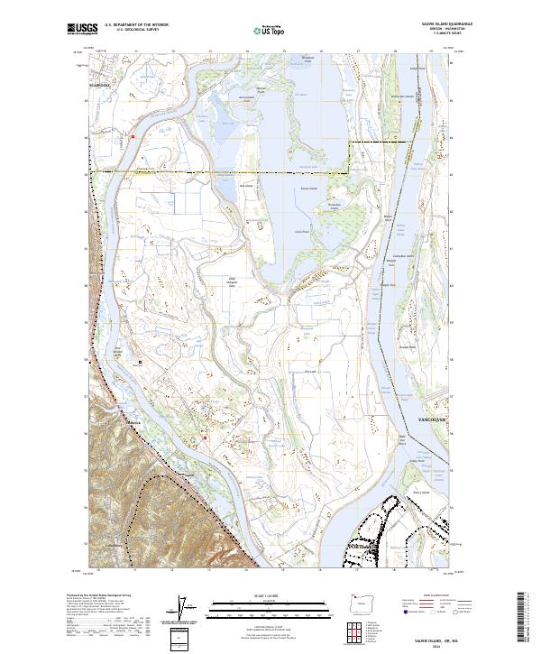
1954 Sauvie Island
Multnomah County, OR
1957 Bonneville Dam
Multnomah County, OR
1961 Linnton
Multnomah County, OR
1961 Mount Tabor
Multnomah County, OR
1961 Sauvie Island
Multnomah County, OR
1975 Linnton
Multnomah County, OR
1975 Mount Tabor
Multnomah County, OR
1976 Mount Tabor
Multnomah County, OR
1979 Tanner Butte
Multnomah County, OR
1986 Bridal Veil
Multnomah County, OR
1986 Multnomah Falls
Multnomah County, OR
1990 Linnton
Multnomah County, OR
1990 Mount Tabor
Multnomah County, OR
1990 Sauvie Island
Multnomah County, OR
1994 Bridal Veil
Multnomah County, OR
1994 Multnomah Falls
Multnomah County, OR
1994 Tanner Butte
Multnomah County, OR
2011 Bonneville Dam
Multnomah County, OR
2011 Bridal Veil
Multnomah County, OR
2011 Linnton
Multnomah County, OR
2011 Mount Tabor
Multnomah County, OR
2011 Multnomah Falls
Multnomah County, OR
2011 Sauvie Island
Multnomah County, OR
2011 Tanner Butte
Multnomah County, OR
2014 Bonneville Dam
Multnomah County, OR
2014 Bridal Veil
Multnomah County, OR
2014 Linnton
Multnomah County, OR
2014 Mount Tabor
Multnomah County, OR
2014 Multnomah Falls
Multnomah County, OR
2014 Sauvie Island
Multnomah County, OR
2014 Tanner Butte
Multnomah County, OR
2017 Bonneville Dam
Multnomah County, OR
2017 Bridal Veil
Multnomah County, OR
2017 Linnton
Multnomah County, OR
2017 Mount Tabor
Multnomah County, OR
2017 Multnomah Falls
Multnomah County, OR

2017 Sauvie Island
Multnomah County, OR

2017 Tanner Butte
Multnomah County, OR
2020 Bonneville Dam
Multnomah County, OR
2020 Bridal Veil
Multnomah County, OR
2020 Linnton
Multnomah County, OR
2020 Mount Tabor
Multnomah County, OR
2020 Multnomah Falls
Multnomah County, OR
2020 Sauvie Island
Multnomah County, OR
2020 Tanner Butte
Multnomah County, OR
2023 Bonneville Dam
Multnomah County, OR
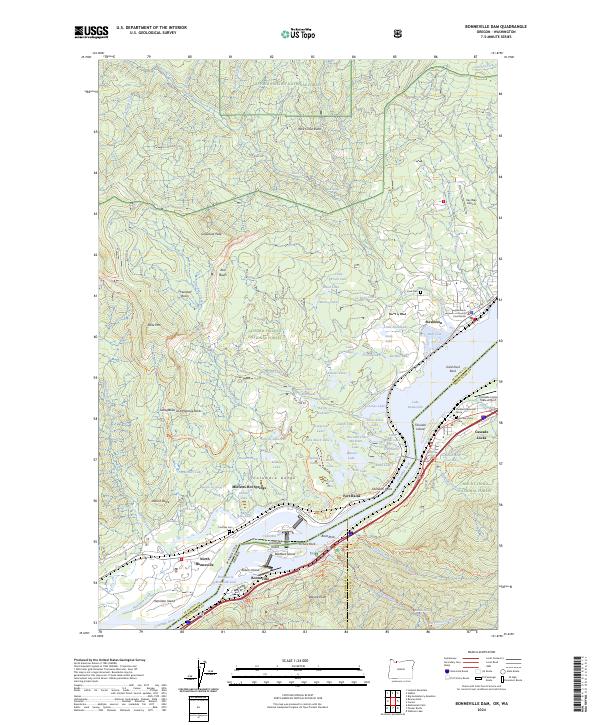
2024 Bonneville Dam
Multnomah County, OR
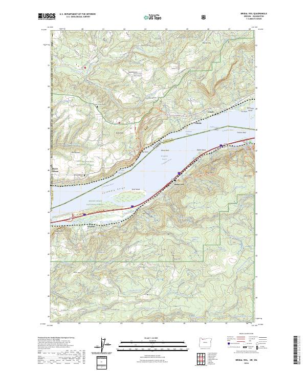
2024 Bridal Veil
Multnomah County, OR
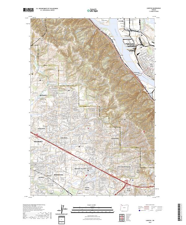
2024 Linnton
Multnomah County, OR
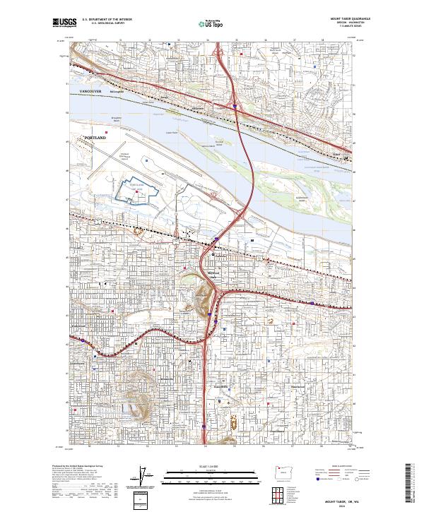
2024 Mount Tabor
Multnomah County, OR
2024 Multnomah Falls
Multnomah County, OR
2024 Sauvie Island
Multnomah County, OR
2024 Tanner Butte
Multnomah County, OR