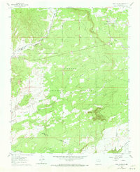
1960 Map of Taos Junction
USGS Topo · Published 1973About this map
Carson National Forest dominates this landscape along the Rio Arriba and Taos county line, defined by a complex network of arroyos and canyons. The presence of the Old RR Grade cutting through the northeast corner reveals the remnants of historic transport routes that once served this high-elevation plateau. Small outposts and named locales like Solo and Taos Junction are situated near the railroad corridor, while Martinez Tank points to the essential role of water management in this arid environment.
Find a feature on this map
18 named features on this map. Tap any name to fly to it.
Don’t see what you’re looking for? This feature index may not catch every label — zoom into the map to look around manually.
Map Details
Editions of this 1960 Taos Junction Map

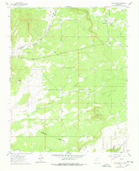
Other maps of this area

1918 · Abiquiu
USGS Topo · 1:125,000

1953 · Lyden
USGS Topo · 1:24,000

1953 · Velarde
USGS Topo · 1:24,000

1953 · Trampas
USGS Topo · 1:24,000

1953 · La Madera
USGS Topo · 1:24,000

1953 · Ojo Caliente
USGS Topo · 1:24,000

1953 · San Juan Pueblo
USGS Topo · 1:62,500

1954 · Raton
USGS Topo · 1:250,000

1954 · Aztec
USGS Topo · 1:250,000

1958 · Raton
USGS Topo · 1:250,000