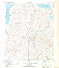
1950 Map of Teller A-3
USGS Topo · Published 1971About this map
Port Clarence and the northern shores of the Seward Peninsula dominate this 1950s-era landscape, where the shifting ice of Grantley Harbor met the seasonal routes of the Alaskan wilderness. The presence of Sullivan Camp and the intricate network of naming across the landscape — from Wild Goose Cr to Gold Run — reflects the legacy of prospecting and hydraulic mining that shaped the interior.
Find a feature on this map
61 named features on this map. Tap any name to fly to it.
Don’t see what you’re looking for? This feature index may not catch every label — zoom into the map to look around manually.
Map Details
Editions of this 1950 Teller A-3 Map
3 editions found
Other maps of this area

1950 · Nome D-2
USGS Topo · 1:63,360

1950 · Nome D-4
USGS Topo · 1:63,360

1950 · Nome
USGS Topo · 1:250,000

1950 · Teller
USGS Topo · 1:250,000

1950 · Teller A-2
USGS Topo · 1:63,360

1950 · Nome D-3
USGS Topo · 1:63,360

1950 · Teller B-4
USGS Topo · 1:63,360

1950 · Teller B-2
USGS Topo · 1:63,360

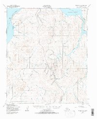
1950 · Teller A-3
USGS Topo · 1:63,360

1950 · Teller A-4
USGS Topo · 1:63,360