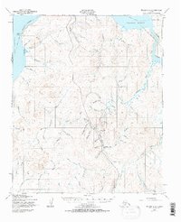
1950 Map of Teller A-3
USGS Topo · Published 1971About this map
Port Clarence and Grantley Harbor define the northern maritime boundary of this interior Seward Peninsula landscape, where the tides meet a network of drainages heavily influenced by early gold exploration. The most prominent human activity is reflected at Sullivan Camp, situated near the convergence of Madame Cr and Bull Pup Cr. The map's hydrography is defined by evocative mining-era names like Gold Standard Cr, Gold Run, and Yellowstone Creek, which carved through the terrain long before modern permanent settlements. A series of overland routes, including the Winter Trail, provided essential seasonal access between the coast at Cape Riley and the inland mining claims. The reliance on these trails and the Tuksuk Channel illustrates the remote logistics of the Seward Peninsula during the mid-20th century.
Find a feature on this map
61 named features on this map. Tap any name to fly to it.
Don’t see what you’re looking for? This feature index may not catch every label — zoom into the map to look around manually.
Map Details
Editions of this 1950 Teller A-3 Map
3 editions found
Other maps of this area

1950 · Nome D-2
USGS Topo · 1:63,360

1950 · Nome D-4
USGS Topo · 1:63,360

1950 · Nome
USGS Topo · 1:250,000

1950 · Teller
USGS Topo · 1:250,000

1950 · Teller A-2
USGS Topo · 1:63,360

1950 · Nome D-3
USGS Topo · 1:63,360

1950 · Teller B-4
USGS Topo · 1:63,360

1950 · Teller B-2
USGS Topo · 1:63,360

1950 · Teller A-3
USGS Topo · 1:63,360

1950 · Teller A-4
USGS Topo · 1:63,360