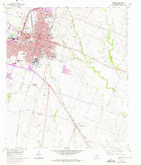
1965 Map of Temple
USGS Topo · Published 1975About this map
The city of Temple serves as a major regional hub in this 1965 survey, defined by its dense network of educational and medical institutions. The map documents numerous segregated and community schools, including Dunbar High Sch, Wheatley Sch, and Bethune Sch, reflecting the civic infrastructure of mid-century central Texas. Beyond the urban core, the Blackland Experimental Farm and the Veterans Administration Center highlight the area's importance to agricultural research and federal services. The landscape transitions from the grid of Temple to the rural expanses of Heidenheimer and Little Flock, where smaller settlements are connected by the Atchison Topeka and Santa Fe and Missouri Kansas Texas railroads. Several family and community burial grounds, such as Greathouse Cem and Lancaster Cem, are tucked away near watercourses like Little Elm Creek.
Find a feature on this map
58 named features on this map. Tap any name to fly to it.
Don’t see what you’re looking for? This feature index may not catch every label — zoom into the map to look around manually.
Map Details
Editions of this 1965 Temple Map
3 editions found
Other maps of this area

1885 · Taylor
USGS Topo · 1:125,000

1887 · Taylor
USGS Topo · 1:125,000

1892 · Temple
USGS Topo · 1:125,000

1894 · Taylor
USGS Topo · 1:125,000

1924 · Temple 3-C
USGS Topo · 1:48,000

1924 · Temple 3-B
USGS Topo · 1:48,000

1931 · Belton
USGS Topo · 1:62,500

1954 · Waco
USGS Topo · 1:250,000

1954 · Austin
USGS Topo · 1:250,000

1955 · Waco
USGS Topo · 1:250,000