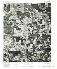
1976 Map of Thayer SW
USGS Topo · Published 1977About this map
Koshkonong serves as the primary focal point of this 1976 orthophotoquad, which covers a portion of Howell County in southern Missouri. Unlike traditional topographic maps, this aerial imagery provides a direct visual record of the landscape as it appeared in the mid-1970s, revealing a complex patchwork of woodlots and agricultural clearings. The town itself is clearly visible along the highway corridor, with individual structures and the local street grid identifiable from above. The surrounding terrain is defined by its land-use patterns, showing the extent of timbered areas and the cleared fields that supported the local rural economy during this period. This visual survey is an essential resource for researchers tracking the physical development of the area or confirming the location of specific farmsteads and rural properties as they existed several decades ago.
Find a feature on this map
1 named feature on this map. Tap any name to fly to it.
Don’t see what you’re looking for? This feature index may not catch every label — zoom into the map to look around manually.
Map Details
Editions of this 1976 Thayer SW Map
This is the sole edition of this map. No revisions or reprints were ever made.
Other maps of this area

1938 · West Plains
USGS Topo · 1:24,000

1940 · West Plains
USGS Topo · 1:24,000

1943 · Thayer
USGS Topo · 1:62,500

1944 · West Plains
USGS Topo · 1:62,500

1946 · Thayer
USGS Topo · 1:62,500

1946 · West Plains
USGS Topo · 1:62,500

1950 · Salem
USGS Topo · 1:62,500

1951 · Salem
USGS Topo · 1:62,500

1957 · Poplar Bluff
USGS Topo · 1:250,000

1959 · Poplar Bluff
USGS Topo · 1:250,000