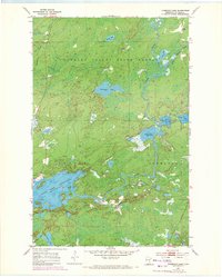
1954 Map of Thompson Lake
USGS Topo · Published 1971About this map
The Cloquet River and its complex network of tributaries define this northern Minnesota landscape within the Cloquet Valley State Forest. This 1954 survey, later photorevised in 1969, captures the intricate hydrology of the region as it transitions into the expansive Island Lake Reservoir. The map illustrates a wilderness area structured by the boundaries of Gnesen and Normanna townships, where glacial activity has left behind a dense concentration of water bodies including Thompson Lake, Alden Lake, and Mouse Lake. This environment reveals a pattern of mid-century conservation and land management, with the state forest designation protecting the timber and watersheds that feed the St. Louis River system. From the winding Little Cloquet River to the smaller Spring Lake and Lost Lake, the sheet provides a meticulous record of the wetlands and forest roads that supported the local timber and recreational economy before significant modern development.
Find a feature on this map
15 named features on this map. Tap any name to fly to it.
Don’t see what you’re looking for? This feature index may not catch every label — zoom into the map to look around manually.
Map Details
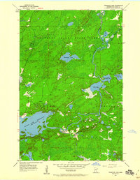
Editions of this 1954 Thompson Lake Map
3 editions found
Other maps of this area

1895 · Duluth
USGS Topo · 1:62,500

1953 · French River
USGS Topo · 1:24,000

1953 · Arnold
USGS Topo · 1:24,000

1953 · Boulder Lake Reservoir
USGS Topo · 1:24,000

1953 · Fredenberg
USGS Topo · 1:24,000

1953 · Duluth
USGS Topo · 1:62,500

1953 · Ashland
USGS Topo · 1:250,000

1953 · Duluth
USGS Topo · 1:250,000

1954 · Barrs Lake
USGS Topo · 1:24,000

1954 · Thompson Lake
USGS Topo · 1:24,000
Featured Places
- Gnesen Township, MN
- Marion Lake, MN
- Normanna Township, MN
- North Star Township, MN
- Saint Louis County, MN