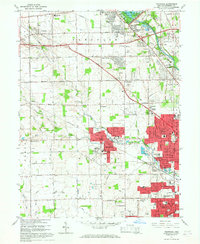
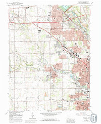
1965 Map of Trotwood
USGS Topo · Published 1967About this map
Trotwood and the western edge of Dayton define this mid-1960s landscape, illustrating a period of suburban expansion into the agricultural Montgomery County countryside. The residential growth is marked by several significant institutional landmarks, including the Precious Blood Convent, Stillwater Sanitarium, and the iconic Hara Arena. The map details the transition from rural crossroads like Taylorsburg and Hays Corner to organized developments such as Fort McKinley and Residence Park.
Find a feature on this map
81 named features on this map. Tap any name to fly to it.
Don’t see what you’re looking for? This feature index may not catch every label — zoom into the map to look around manually.
Map Details
Editions of this 1965 Trotwood Map
5 editions found
Other maps of this area

1904 · Dayton
USGS Topo · 1:62,500

1905 · Brookville
USGS Topo · 1:62,500

1906 · Dayton
USGS Topo · 1:62,500

1908 · Miamisburg
USGS Topo · 1:62,500

1913 · Waynesville
USGS Topo · 1:62,500

1915 · Waynesville
USGS Topo · 1:62,500

1953 · Cincinnati
USGS Topo · 1:250,000

1955 · Miamisburg
USGS Topo · 1:24,000

1955 · Dayton South
USGS Topo · 1:24,000

1955 · West Milton
USGS Topo · 1:24,000