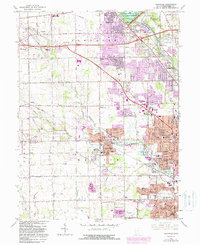
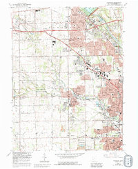
1965 Map of Trotwood
USGS Topo · Published 1988About this map
Trotwood and the surrounding townships of Randolph, Madison, and Butler are captured during a period of significant suburban expansion northwest of Dayton. The landscape is defined by the drainage of Wolf Creek and its many branches, including North Branch Wolf Creek, which carve through the terrain toward the Stillwater River. Significant land use shifts are evident in the late mid-century, with the establishment of Sycamore State Park and the preservation of the Englewood Reserve within the Miami Conservancy District. This survey highlights a transitional era where traditional agricultural lands and rural settlements like Happy Corners and Amity meet the encroaching residential developments of Fort McKinley and Residence Park. Transportation networks are prominent, featuring the Conrail line and the intersection of the historic National Road with newly established interstate interchanges.
Find a feature on this map
85 named features on this map. Tap any name to fly to it.
Don’t see what you’re looking for? This feature index may not catch every label — zoom into the map to look around manually.
Map Details
Editions of this 1965 Trotwood Map
5 editions found
Other maps of this area

1904 · Dayton
USGS Topo · 1:62,500

1905 · Brookville
USGS Topo · 1:62,500

1906 · Dayton
USGS Topo · 1:62,500

1908 · Miamisburg
USGS Topo · 1:62,500

1913 · Waynesville
USGS Topo · 1:62,500

1915 · Waynesville
USGS Topo · 1:62,500

1953 · Cincinnati
USGS Topo · 1:250,000

1955 · Miamisburg
USGS Topo · 1:24,000

1955 · Dayton South
USGS Topo · 1:24,000

1955 · West Milton
USGS Topo · 1:24,000