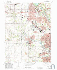
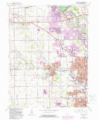
1965 Map of Trotwood
USGS Topo · Published 1992About this map
Trotwood and the western suburbs of Dayton appear at a moment of significant mid-century suburban expansion, where residential grids actively press against traditional Montgomery County farmland. The landscape is defined by the drainage of Wolf Creek and the Stillwater River, which shape the location of older crossroads settlements like Little York, Clayton, and Englewood. This 1965 revision, updated in the late 1980s, captures institutional landmarks like the Precious Blood Convent and Stillwater Sanitarium before further modernization. To the west, Sycamore State Park provides a notable contrast to the intensifying development near Stillwater Junction and the Hara Arena. Traces of the region's agricultural and industrial roots remain visible through scattered Quarries, the Penn Central rail line, and the Dayton - New Lebanon Airport.
Find a feature on this map
81 named features on this map. Tap any name to fly to it.
Don’t see what you’re looking for? This feature index may not catch every label — zoom into the map to look around manually.
Map Details
Editions of this 1965 Trotwood Map
5 editions found
Other maps of this area

1904 · Dayton
USGS Topo · 1:62,500

1905 · Brookville
USGS Topo · 1:62,500

1906 · Dayton
USGS Topo · 1:62,500

1908 · Miamisburg
USGS Topo · 1:62,500

1913 · Waynesville
USGS Topo · 1:62,500

1915 · Waynesville
USGS Topo · 1:62,500

1953 · Cincinnati
USGS Topo · 1:250,000

1955 · Miamisburg
USGS Topo · 1:24,000

1955 · Dayton South
USGS Topo · 1:24,000

1955 · West Milton
USGS Topo · 1:24,000