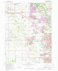
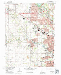
1965 Map of Trotwood
USGS Topo · Published 1975About this map
Trotwood serves as the focal point of this mid-century portrait of Montgomery County, where suburban expansion meets the established agricultural grid of Madison and Randolph townships. The Stillwater River carves through the northeast, bordered by the extensive Miami Conservancy District (Englewood Reserve), a critical component of regional flood control. Transportation corridors like the historic National Road and the Penn Central railroad facilitate growth, connecting smaller communities such as Clayton and Englewood to the northern reaches of Dayton.
Find a feature on this map
84 named features on this map. Tap any name to fly to it.
Don’t see what you’re looking for? This feature index may not catch every label — zoom into the map to look around manually.
Map Details
Editions of this 1965 Trotwood Map
5 editions found
Other maps of this area

1904 · Dayton
USGS Topo · 1:62,500

1905 · Brookville
USGS Topo · 1:62,500

1906 · Dayton
USGS Topo · 1:62,500

1908 · Miamisburg
USGS Topo · 1:62,500

1913 · Waynesville
USGS Topo · 1:62,500

1915 · Waynesville
USGS Topo · 1:62,500

1953 · Cincinnati
USGS Topo · 1:250,000

1955 · Miamisburg
USGS Topo · 1:24,000

1955 · Dayton South
USGS Topo · 1:24,000

1955 · West Milton
USGS Topo · 1:24,000