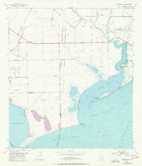
1952 Map of Turtle Bay
USGS Topo · Published 1976About this map
Camp Hulen occupies a prominent position on the shoreline of Turtle Bay and Tres Palacios Bay in this mid-century topographic survey of the Texas coast. The map illustrates a complex coastal environment where freshwater systems like Buttermilk Slough and Turtle Creek meet the expansive waters of Matagorda Bay. Significant aviation and communication infrastructure is present, including the Palacios Municipal Airport and the Palacios Radio Range Station, reflecting the area's strategic importance during and after the war years.
Find a feature on this map
23 named features on this map. Tap any name to fly to it.
Don’t see what you’re looking for? This feature index may not catch every label — zoom into the map to look around manually.
Map Details
Editions of this 1952 Turtle Bay Map
Other maps of this area

1951 · Keller Bay
USGS Topo · 1:24,000

1952 · Palacios Point
USGS Topo · 1:24,000

1952 · Palacios
USGS Topo · 1:24,000

1952 · Olivia
USGS Topo · 1:24,000

1952 · Turtle Bay
USGS Topo · 1:24,000

1952 · Francitas
USGS Topo · 1:24,000

1952 · Blessing
USGS Topo · 1:24,000

1952 · La Ward
USGS Topo · 1:24,000

1953 · Beeville
USGS Topo · 1:250,000

1956 · Beeville
USGS Topo · 1:250,000
Featured Places
- Palacios, TX
- Schicke Point Community, TX
- El Campo Club Community, TX
- Matagorda County, TX
- Calhoun County, TX